
Land Uses and Spatial Approach in the Garden Community
Here you can view our policies for 'Land Uses and Spatial Approach', and, 'Requirements for all New Development in the Garden Community'. To see the Draft Plan in full (PDF), or to see other polices in our Draft Plan - please refer to the useful links on this page.
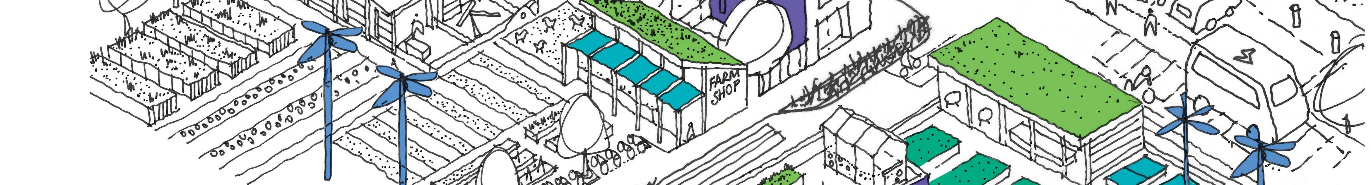
This chapter sets out the big decisions about what land will be included in the Garden Community, how the development will be laid out, which areas will be allocated to housing, employment, open space or other uses or infrastructure, and which areas will be protected from development.
The approach has been informed by a thorough masterplanning process, which has been supported by an appropriate evidence base with technical analysis, survey work and the comments of local people, stakeholders, and other interested parties as part of public engagement activities.
As well as explaining, in broad strategic terms, how different parts of the site are expected to be developed and protected, Policy 1 also sets out how this draft Plan will be followed by additional future masterplanning and design codes, for both the whole Garden Community and neighbourhoods within it, and how these will be adhered to when considering detailed proposals and specific planning applications. Policy 1 is supported by a Key Diagram.
Policy 2 in this Chapter then sets out the Councils’ general requirements for all new development proposals in, or affecting, the Garden Community which alongside other policies in this Plan will be applied in the determination of planning applications. These requirements will not only apply to the development of the Garden Community itself, but also future applications for new developments, alterations, and changes of use in the Garden Community once it is established.
1. Section 1 Local Plan
In terms of overall land use and the spatial approach for the Garden Community, some of the main requirements expected to be covered in this draft Plan, as set out in the policies of the adopted Section 1 Local Plan, include:
- a defined boundary for the new community and the amount of development it will contain (including 7,000-9,000 new homes, as well as 25 hectares of employment land, new ‘centres’, new schools and early years facilities, and provision for gypsies and traveller accommodation);
- land to accommodate the future expansion of the University of Essex;
- a conceptual plan showing the make-up and quantity of future land-uses;
- a three-dimensional indication of the urban design and landscape parameters which will be incorporated into any future planning applications;
- defined landscape buffers to maintain clear separation between the Garden Community, existing development in Colchester and the villages of Wivenhoe and Elmstead Market;
- the relationship and integration of the Garden Community with the A120-A133 Link Road and the Rapid Transit System (RTS) – including their proposed route and access points;
- designating a new country park along the Salary Brook corridor, incorporating Churn Wood; and
- a layout that draws upon the context and considerable assets within its boundaries (including woodland, streams, and changes in topography) and the opportunities afforded by the proximity of the University of Essex.
2. Engagement feedback
What we heard
Some of the main messages that have arisen through the engagement with residents, communities, stakeholders, and other interested parties in relation to how the Garden Community should be laid out, and which have informed the Councils’ approach, include:
- Strong views from some that there should be no development south of the A133 to ensure land between the Garden Community and Wivenhoe is kept open and the two do not merge or ‘coalesce’ together in the future.
- Similar concerns from residents of Elmstead Market and a suggestion that there should be a green buffer between the new A120-A133 Link Road and the village.
- Strong support for the creation of a new country park, to include Salary Brook Local Nature Reserve and Salary Brook slopes, that should be protected from development, to maintain the important green edge to Colchester.
- A desire for the loose-knit rural character of Crockleford Heath, and other dispersed dwellings within the broad location of the Garden Community, to be protected and respected through the layout of the development.
- Development should be of a density that allows space for green corridors, greenery, and openness in line with Garden Community principles.
- The layout of the development should not result in increased traffic congestion on existing roads and must attempt to promote and prioritise walking, cycling and public transport, whilst acknowledging sensible and practical provision for private car and van users.
- The development must provide a variety of employment and education opportunities across a range of sectors to maximise the opportunities for new and existing residents to access jobs and support the future growth of the university and its spin off activities.
- The development ought to make an efficient use of land and minimise sprawl into the open countryside, with a high level of open space and green infrastructure within the development.
What we’ve done
The Councils agree that development should make efficient use of land, promote sustainable travel, and include a high level of open space, green corridors, and green and blue infrastructure. Strategic green gaps between the Garden Community and Colchester, Wivenhoe, and Elmstead Market; and a country park, including Salary Brook Local Nature Reserve and Salary Brook slopes, are shown on the Key Diagram and required by Policy 1. The Councils agree that it is important to retain the loose-knit rural character of Crockleford Heath and propose to designate Crockleford Heath as an Area of Special Character.
3. Policy 1: Land Uses and Spatial Approach
Taking forward the requirements of the Section 1 Local Plan and taking into account the views of local people and other stakeholders, Policy 1 sets out the key land uses and spatial parameters within which the Garden Community is expected to be built. It also sets out the Councils’ expectations for the information that will need to be submitted and approved ahead of the determination of any outline or detailed planning applications for development of the Garden Community. This will enable the Councils to ensure that development will achieve a comprehensive approach that delivers garden community principles and the Councils’ high expectations for design and quality as set out in this draft Plan.
POLICY 1: LAND USES AND SPATIAL APPROACH The Garden Community will be an inclusive, safe, and healthy community. It will represent sustainable development and manage natural and heritage assets wisely for future generations. The Garden Community will make the fullest possible contribution to minimising greenhouse gas emissions in accordance with the energy and waste hierarchies through ensuring resource efficiency, minimisation of waste, reduction in embodied carbon and the prioritisation of renewable energy. Proposals will mitigate against and improve resilience to the effects of climate change and contribute positively to the health, wellbeing and resilience of communities and the natural environment. Part A: Settlement Development Boundary and Key Diagram Development of the Tendring Colchester Borders Garden Community will be confined to land within the ‘Settlement Development Boundary’ and will adhere to the land use parameters, as shown on the Key Diagram. Land within (and in some areas adjoining) the Garden Community site is specifically allocated or protected for the following uses:
Proposals for development at the Garden Community must be in general conformity with the Key Diagram and meet the specific requirements of policies elsewhere in this draft Plan and in the adopted Section 1 Local Plan. To ensure a comprehensive approach to development that meets with the Councils’ high expectations for design and quality and the key principles that underpin the development of Garden Communities, proposals seeking planning permission must also adhere to a ‘Strategic Masterplan’ and ‘Strategic Design Code’ for the whole site and more specific and detailed ‘Neighbourhood Masterplans’ and ‘Neighbourhood Design Codes’ for the relevant neighbourhood. These will be informed by use of design review and assessment frameworks such as the National Design Guide, National Model Design Code, Building for a Healthy Life and Building with Nature, or similar. These Masterplans and Design Codes will be prepared and approved by the Councils, through a collaborative process with key stakeholders before the consideration of detailed proposals and determination of planning applications. Land outside of the Settlement Development Boundary and the designated Strategic Green Gaps will be treated as ‘open countryside’ where new development will generally be limited to that related to agriculture and other activities consistent with a countryside location, or that are otherwise consistent with any adopted Neighbourhood Plans applicable to the land in question. Any proposal for land within or nearby the Garden Community site that would prejudice the comprehensive development of the Garden Community, as envisaged by the Key Diagram, the policies in this draft Plan or any subsequently approved Masterplans or Design Codes, will not be supported by the Councils. Part B: Neighbourhoods Each neighbourhood will adopt appropriate approaches to architecture, design, character, development density and public space to achieve a distinctive sense of place for each area that will appeal to a variety of needs and lifestyles. The approaches to development will also reflect the varying levels of physical and environmental opportunities and constraints across the site, as well as proximity to existing communities, key features, and assets – such as green spaces, woodland, heritage assets, the University of Essex, new and existing roads, and walking and cycling connections. Residents within each neighbourhood should have high accessibility to local services and facilities – within a 15 minute walk time or with high accessibility by cycling or public transport. To promote the use of walking, cycling and public transport as sustainable and convenient alternatives to the private car, each neighbourhood will contain at least one ‘centre’ containing facilities such as shops, services, and community facilities, and could include employment land and job opportunities, which will be located within walking and cycling distance of the new homes within that neighbourhood. Land and property will be provided in the form of ‘hubs’ within and around the centres to provide for a flexible range of local business needs alongside service sector jobs provided by new schools, nurseries, shops and community facilities. In addition, the new Rapid Transit System will connect to each of the neighbourhoods as part of a network, providing fast connectivity between them and key areas of employment both within the site and in surrounding areas, such as the University of Essex, Colchester Town Centre, Colchester General Hospital, and Colchester Sports Park. Each of the three neighbourhoods will be accessible by private car and commercial vehicles but will be accessed independently from separate junctions on the new A120-A133 Link Road (as opposed to the A133 and A120 themselves) to give greater priority to the Rapid Transit System and other sustainable travel opportunities. The Councils will also work with the University of Essex and other partners, where necessary and appropriate, to deliver key infrastructure relating to health, education, and other community activities to serve the early phases of development at the Garden Community, either on a permanent basis or on an interim basis ahead of the establishment of the first of the new centres. Part C: Strategic Green Gaps Land within the Strategic Green Gaps will be protected from development that would prejudice the openness of the land in question, and that would either bring about or contribute towards coalescence. Proposals for the construction of new buildings in the Strategic Green Gaps will only be supported where they represent the provision of appropriate development for a countryside location or facilities (in connection with the existing use of land or a change of use), for outdoor sport or recreation (for example, new facilities associated with growth at the University of Essex or local schools), cemeteries and burial grounds or allotments. Any such development must conform with the purpose of the Strategic Green Gap designation, nor prejudice the delivery of the Garden Community. Part D: Crockleford Heath Area of Special Character Land and property comprising the rural community of Crockleford Heath, Ardleigh, is identified as an ‘Area of Special Character’ in recognition of its rural, loose-knit and sparsely developed settlement form and the distinctive and attractive network of green lanes and small fields that pass through it. The Area of Special Character is defined on the Key Diagram. The Area of Special Character will be treated in the same way as undesignated open countryside, outside of the Settlement Development Boundary where general ‘countryside policies’ will apply. Any proposals for new development in the Area of Special Character will be considered on their individual merits as ‘windfall’ development which could include low density and individually designed self-build and custom build homes. In determining any proposals for development, the Councils will give special regard to preserving and/or enhancing the loose knit and low-density rural character of Crockleford Heath and its setting, reducing traffic on its narrow rural roads and ensuring the development of the Garden Community around Crockleford Heath also respects its rural setting. Part E: Salary Brook Country Park Land and woodland around Salary Brook Local Nature Reserve is designated as a new Country Park that will be promoted and managed for that purpose. The Country Park will be protected and enhanced as an important corridor for wildlife conservation, informal recreation, and education, and will connect to the wider network of green and blue infrastructure and walking/cycling routes serving the Garden Community and its neighbourhoods. This designation will give extra protection to the countryside to the west of the Garden Community, to maintain long-term physical and visual separation to the nearby settlement of Colchester. Part F: University Expansion Land Land adjacent to the University of Essex, as shown on the Key Diagram as ‘University Expansion Land’, is allocated to accommodate new buildings and ancillary activities related to the University such as education, research and administrative functions. Two alternative approaches for this provision are being considered and are shown on the Key Diagram (and relevant maps within the appendices to this Plan). Either one of these approaches would provide the same amount of land as required by the adopted Section 1 Local Plan. Approach A uses land north of the university campus and the A133 alongside land to be used for additional Knowledge Based Employment. To maximise the potential use of such land, leisure, sports and recreation activities are not considered suitable as part of this specific university expansion designation and should be provided elsewhere. Approach B uses land to the east of Colchester Road (B1028) and south of the A133 around which there would be a Strategic Green Gap to ensure no coalescence with neighbouring Wivenhoe. Leisure, sports and recreation activities may be suitable in this location. Part G: Knowledge Based Employment Land Two alternative approaches to the allocation of land for knowledge based employment purposes are under consideration on land directly opposite the University of Essex campus. Approach A involves 4 hectares of land being provided for knowledge based employment purposes alongside land for the expansion of the University. Approach B involves 8 hectares of land for the extension of the Knowledge Gateway located further westwards towards Colchester to be directly opposite the existing Knowledge Gateway and access point to the University and Knowledge Gateway from the A133. Part H: A120 Industrial Business Park Land immediately south of the A120 and east of the new A120-A133 Link Road, as shown on the Key Diagram as ‘A120 Industrial Business Park’, is allocated for a new Industrial Business Park, principally for general business and industrial purposes, that could provide a range of unit sizes for different occupiers. The land will be accessed via the new A120-A133 Link Road and will be connected to the Rapid Transit System. Part I: Provision for Gypsies and Travellers A new site for the accommodation of gypsies and travellers will be delivered within the northern neighbourhood of the Garden Community south of the A120 and west of the new A120-A133 Link Road with good access to those roads. The precise location and size of the site and details of its layout and configuration will be determined through an up-to-date Gypsy and Traveller Needs Assessment, that will inform the detailed Neighbourhood Masterplan to be approved by the Councils ahead of any proposals for development at the northern neighbourhood. Part J: Park and Choose Facilities Two new Park and Choose facilities will provide the opportunity for visitors by car to access the walking, cycling and Rapid Transit System (RTS) networks that connect to the Garden Community, Colchester, and the wider area. These will be located at locations where the RTS route intersects with important transport corridors and the two principal areas of employment uses. One is proposed south of the A120 and east of the A120-A133 Link Road related to the A120 Industrial Business Park (Part H); and one in close proximity to the A133. |
Key Diagram:
(You can also download Approach A and Approach B)

4. Justification
The chosen strategy for development at the Garden Community confines the majority of development to land south of the A120, north of the A133, west of the new A120-A133 Link Road and east of the new country park (Part E) to be designated around Salary Brook Local Nature Reserve. In addition, selected land and property in the area of Crockleford Heath has been specifically identified as an Area of Special Character (Part D), where it will be protected from anything other than small scale and sympathetic low-density development, appropriate for a countryside location and that respects the area’s loose-knit rural character.
Land is designated and shown on the Key Diagram as Strategic Green Gaps. Land within the Strategic Green Gaps will be protected from most forms of built development to ensure the Garden Community does not extend or sprawl into locations where it could eventually merge or coalesce with Wivenhoe, Elmstead Market or Colchester – one of the main concerns raised by local people throughout the public engagement activities. Additional open space is proposed adjacent to Salary Brook Local Nature Reserve to strengthen this area as a buffer to the Colchester urban area encompassing the steep adjoining slopes of the brook as well as nearby woodland. This designation will also prevent coalescence in the Greenstead and Longridge areas.
Because the Councils have decided to restrict the development to land within tight boundaries defined by the proposed Strategic Green Gaps (Part C) and the physical constraints formed by the existing and proposed roads, the total number of new homes expected at the Garden Community has been refined to approximately 7,500- 8,000. This is towards the lower end of the 7,000 to 9,000 range set out in the adopted Section 1 Local Plan.
The 7,500-8,000 new homes will be delivered across three distinct but interconnected ‘neighbourhoods’ (Part B) in the south, central and north parts of the site, each with associated facilities and infrastructure. Broad locations for these neighbourhoods are shown on the Key Diagram. Each neighbourhood will adopt its own approach to architecture, design, character, development density and public space to achieve a distinctive ‘sense of place’ for each area, that will appeal to a variety of needs and lifestyles. The number of homes and density of housing development will vary both within and across the neighbourhoods, with a general expectation that the overall average density of development will be higher in the southern neighbourhood to reflect its proximity to the University of Essex, and the opportunity for early connection to the Rapid Transit System; and lower in the northern neighbourhoods, further from the University, and which reflects the more sensitive nature of the landscape and existing communities further north.
Each neighbourhood will be served by at least one ‘centre’ and focused around high accessibility to the Rapid Transit System. Each neighbourhood will contain a range of employment land and job opportunities, shops, services, and community facilities, including green infrastructure, which will be located within close walking and cycling distance of the new homes, within the relevant neighbourhood, designed to help reduce people’s reliance on private cars.
The Garden Community will be planned and developed on the concept of a “15- minute neighbourhood”, and this draft Plan involves a range of interrelated policy actions that seeks to provide residents access to most of their daily needs within a short walk or cycle ride from their home. To help achieve this, higher density development will be focused around each centre. The 15-minute neighbourhood principle makes life more livable for residents, by improving air quality and making neighbourhoods safer, quieter, more diverse, inclusive, and economically vibrant.
Another way of minimising the reliance on private car use is to promote and prioritise sustainable travel choices such as walking, cycling and use of public transport, including the new Rapid Transit System, by making them as convenient as possible, whilst still accommodating the practical needs of private car users and users of commercial vehicles. To help achieve this, as well as providing services and facilities within walking and cycling distance of new homes, connectivity through and between the three neighbourhoods will be primarily limited to walking, cycling and public transport, including the Rapid Transit System. The neighbourhoods will be accessible by private car and commercial vehicles with appropriate levels of parking and electric charging facilities provided, however, access will be from separate junctions on the new A120-A133 Link Road i.e. with more limited direct vehicle access between the neighbourhoods. This approach will help to promote and prioritise sustainable transport choices and reduce the possibility of ‘rat-running’ through the Garden Community.
Two new ‘Park and Choose’ facilities (Part J) are proposed for the Garden Community to enable visitors by car from the north and from the south to access more sustainable transport choices such as walking, cycling and the Rapid Transit System (RTS), which can also provide access to key areas of employment and services within Colchester.. These will be located at locations where the RTS route intersects with important transport corridors and the two principal areas of employment uses. One is proposed south of the A120 and east of the new A120- A133 Link Road related to the A120 Industrial Business Park (Part H); and one in close proximity to the A133.
The approach taken to delivering employment and higher education at the Garden Community is designed to deliver a range of job and training opportunities across different sectors, which could include general business and industrial activity, to research and development, construction, and services. Two principal areas of employment land have been allocated – one is proposed immediately south of the A120 and east of the new A120-A133 Link Road (Part H) primarily to serve the needs of general business and industry (which could include manufacturing of green technologies and modular components to assist in construction of the new homes and buildings at the Garden Community); and one is proposed on land north of the A133 adjacent to the University of Essex and Knowledge Gateway (Part G). Suitable early years and childcare facilities, and primary and secondary schools will also be provided.
The Councils support the University of Essex in its future plans to expand services, increase student intake and provide business, research and development space and sports facilities, and will support appropriate proposals that will help to achieve this both within and beyond the plan period.
There are alternative approaches presented as part of this consultation draft Plan for the Knowledge Based Employment land north of the A133 and directly opposite the existing Knowledge Gateway (Part G), and for the location of expansion of the University of Essex (Part F) for which no preference is currently indicated in the draft Plan. These alternative approaches are shown on the Key Diagram and the maps within the appendices of this Plan. The inclusion of these alternative approaches in the draft Plan follows on from engagement and communication with the University of Essex, which is keen to ensure the Garden Community provides the opportunity to support its long-term expansion and the creation of jobs. The alternative approaches involve different scales of development with different implications for connectivity with the existing Knowledge Gateway, commercial deliverability, accessibility, impact on land around Salary Brook, and the size of any green gap south of the A133 and north of Wivenhoe. These alternatives require further assessment and technical consideration, including taking into account public and stakeholder feedback, before the Councils make a final choice.
Land and property will be provided in the form of ‘hubs’ within and around the centres to provide for a flexible range of local business needs alongside service sector jobs provided by new schools, shops and community facilities. New homes and business premises will also be designed and served by the necessary digital infrastructure to accommodate and promote home working and self-employment.
At this early stage of planning for the Garden Community, it is not possible, nor sensible, for this draft Plan to contain full or precise details of design, layout and appearance of the new buildings and spaces that will be delivered. Instead, this draft Plan provides the overarching strategy and policies that will provide direction for more detailed Masterplans, Design Codes and, ultimately, planning applications to follow. To ensure the highest standard of design, quality, and distinctiveness in terms of architecture, layout and public realm, the Councils’ expectation is for a further site-wide ‘Strategic Masterplan’ and ‘Strategic Design Code’ for the overall layout of the Garden Community to be prepared which, in turn, would be followed by more detailed ‘Neighbourhood Masterplans’ and ‘Neighbourhood Design Codes’ for the relevant neighbourhood, in addition to design codes on specific issues, such as water and biodiversity. The Masterplans and Design Codes will be prepared and approved by the Councils and developed through engagement with residents, businesses, and other stakeholders. The Councils will expect planning applications for development to comply with these Masterplans and Design Codes.
5. Alternative approaches
In determining the approach set out in Policy 1 above, the Councils, in following a comprehensive masterplanning process, considered a range of alternative options and approaches – taking into account both technical evidence and the views expressed through public engagement. This included strategies that involved development expanding over a wider footprint onto land south of the A133 and/or east of the new A120-A133 Link Road as well as development at the lower and higher end of the 7,000 to 9,000 home range set out in the adopted Section 1 Local Plan. The masterplan options are detailed in the Masterplan Design Options document, which is part of the background evidence base.
The Councils also considered different ways of accommodating higher and lower densities of development across different parts of the site, alternative approaches to ‘green/ landscape buffers’ around the edge of the site and different approaches to accommodating ‘centres’, identifying locations for employment and routing the Rapid Transit System through the site. The Councils also considered different approaches to the special character of Crockleford Heath, and different levels of protection that could be given to the land and property in that area.
It is a requirement of the national planning system for the Councils to have considered a number of ‘reasonable alternatives’ in coming to a preferred option. These reasonable alternatives have to be the subject of a Sustainability Appraisal which considers the potential environmental, social and economic effects to assist the Councils in making the right choices.
The main reasonable alternatives considered by the Councils in respect of the overall spatial approach to the Garden Community and for which a Sustainability Appraisal was undertaken were:
- Maximum development area. A strategy that includes development on a wider area of land of the agreed ‘broad area of search’, including land south of the A133 and to the east of the new A120-A133 Link Road allowing for a lower density of development. This option prioritises full site connectivity with the Rapid Transit System network - key to maximising the development opportunity and connecting through the whole Garden Community. It allows for four centres with differing roles and characters that respond to their setting and a range of residential densities. It provides employment clusters in the north-east and south.
- Maximum connectivity. A strategy that confines the majority of development to land north of the A133 and to the west of the new A120-A133 Link Road, but which delivers a higher average density of development with a reasonable level of open space and green infrastructure integrated into the development. It prioritises full site connectivity with the Rapid Transit System network - key to connecting all parts of the Garden Community and allows for four centres. It provides employment clusters in the north-east and south of the Garden Community.
- Additional approaches have also been considered in respect of alternative approaches and extents of land uses around the University of Essex and Knowledge Gateway.
Each of the options have different consequences for the provision of open space and other green infrastructure and land for community facilities and employment, the potential for economic growth, and the impact on the landscape and the character of neighbouring communities. Details of these alternatives are included in the Masterplan Design Options document.
The Councils consider the most appropriate approach is to be based upon the maximum landscape option, when considered against the reasonable alternatives (option 3 in the Masterplan Design Options report). Whilst it requires a higher average density of new homes overall, it can still be accommodated with the flexibility to deliver different types of housing of different sizes, types, heights, and densities to be delivered in different locations across the site. Developing at high densities responds to the climate emergency and maximises opportunities for sustainable travel. This approach enables the development to be achieved to minimise overall land take whilst still providing space for a healthy network of open space and green infrastructure and to protect and respect the community and character of Crockleford Heath, and other sensitive features of the site.
The approach allows employment opportunities to be delivered both on key strategic sites and within centres and provides the means by which a Rapid Transit System can be routed through the three neighbourhoods of the Garden Community, separated from the A120-A133 Link Road and prioritised over private car access. The preferred option also ensures that the main residential communities within the Garden Community are not segregated by the new A120-A133 Link Road or the A133, and that there is space within the development to achieve the green and spacious approach that is key to the Councils’ expectations of a Garden Community.
The Sustainability Appraisal concluded that this approach was found to perform more sustainably than the alternatives. This reflects the higher proportion of the site that would remain undeveloped, with increased benefits in terms of preserving local landscape character, the setting of nearby settlements and heritage assets and greenspace for habitat provision and connectivity. This approach was also found to perform more favourably in terms of limiting the need to travel by car, given the higher density and more compact form of development that would result. This approach is considered mostly likely to provide residents with easy access to a range of services and facilities within the Garden Community at the new centres. The approach would also limit the potential for a portion of residents to be located to the south of the A133 (as would result through options 1 and 2) where they would experience a degree of severance from the rest of the Garden Community.
The Councils have also considered alternative approaches in relation to expansion of the University of Essex and Knowledge Gateway and these approaches are both shown on the Key Diagram. This requires further assessment and technical consideration before the Councils make a final choice and the views of the public and stakeholders are sought.
To make comments on this policy use the tool at the bottom of this page.
Here you can also view our policy for Requirements for all New Development. To see the Draft Plan in full (PDF), or to see other polices in our Draft Plan - please refer to the useful links on this page.
Policy 2 contains the minimum design criteria against which all development proposals for the Garden Community and any subsequent developments or changes of use will be considered. The requirements of this policy apply alongside other relevant policies relating to the Garden Community in the adopted Section 1 Local Plan, as well as other relevant policies in this draft Plan. They will also apply alongside any relevant Masterplans or Design Codes.
The requirements of this policy are broadly consistent with those applied by both Councils to other developments outside of the broad location for the Garden Community, as set out in their separate Section 2 Local Plans. They have been included in this draft Plan to ensure a consistent approach to new development in this cross-boundary location – both in the development of the Garden Community itself and any future planning applications for development or changes of use. This policy applies to all land within the ‘broad location’ for the Garden Community, identified in the Section 1 Local Plan.
POLICY 2: REQUIREMENTS FOR ALL NEW DEVELOPMENT All new development (including changes of use) within the broad location for the Garden Community in the Section 1 Local Plan will be required to meet the criteria for design, practical requirements and impacts compatibility set out in Parts A, B and C of this policy below. These will apply to the development of the Garden Community itself and any future development proposals or changes of use in the area. Part A: Design All new development (including changes of use) must be designed to a high standard, maximise health and wellbeing, achieve high standards of amenity, make a positive contribution to the quality of the local environment, and protect or enhance local character. To achieve this, the following criteria must be met:
Part B: Practical Requirements All new development (including changes of use) must meet practical requirements. The following criteria must be met:
Part C: Impacts and Compatibility New development (including changes of use) should be compatible with surrounding uses and minimise any adverse environmental impacts. The following criteria must be met:
Any measures necessary to meet the above requirements are to be established by the developer. |
Justification
Policy 2 has been included in this draft Plan to set out the very minimum requirements that all proposals for development will be expected to meet within the broad location of the Garden Community, whether they relate to the development of the new Garden Community itself or whether they relate to future development proposals affecting the area once construction has taken place and a new community has been established, either in part or in whole.
Because this draft Plan is a joint plan crossing the administrative boundary of Tendring and Colchester, neither policies contained within the Section 2 Local Plans of TDC or CBC would apply to the broad location for the Garden Community. It is therefore important to ensure that any necessary policies that would apply elsewhere in Tendring or Colchester are included in this draft Plan, so they also apply to the Garden Community and the area within the broad location immediately surrounding it – ensuring a consistent approach on both sides of the administrative boundary. The requirements of the policy are broadly consistent with those applied by both Councils to other developments outside of the broad location for the Garden Community as set out in their separate Section 2 Local Plans, which have both proceeded separately through the process of independent examination by a government-appointed Planning Inspector.
Part A of the policy provides the minimum planning criteria for ensuring development is well designed and relates well to its surroundings. Part B ensures that practical requirements have been addressed and Part C ensures that potential impacts on surrounding uses and/or the local environment are identified, and measures are put in place to ensure any adverse impacts are minimized. Applications will also need to comply with relevant Masterplans and Design Codes and comply with the strategies and studies required in support of planning applications.
Alternative approaches
The Councils have considered the following alternative to this policy:
Alternative 1: No policy in the Plan.
The main problem with having no such policy is that the land and property within the broad location of the Garden Community would not be subject to the same minimum expectations applied to the land and property elsewhere within Tendring and Colchester, to which policies in Section 2 of the Councils’ respective Local Plans apply. There would also be very limited guidance for the Councils to apply in the determination of future planning applications affecting the area once the new Garden Community had already been established, either in part or in whole.
Having a detailed policy in this draft Plan ensures that any subtle differences in wording between the policies in the Councils’ respective Section 2 Local Plans are addressed to avoid any confusion and ensure a consistent approach to dealing with proposals in this cross-border location.
Our video summary of the Land Uses and Spatial Approach policy
-
A short video summarising the policy for Land Uses and Spatial Approach.
Our video summary of the Requirements for all New Development policy
-
A short video summarising the policy for Requirements for all New Development.
